
品质至上,客户至上,您的满意就是我们的目标
当前位置: 首页 > 新闻动态
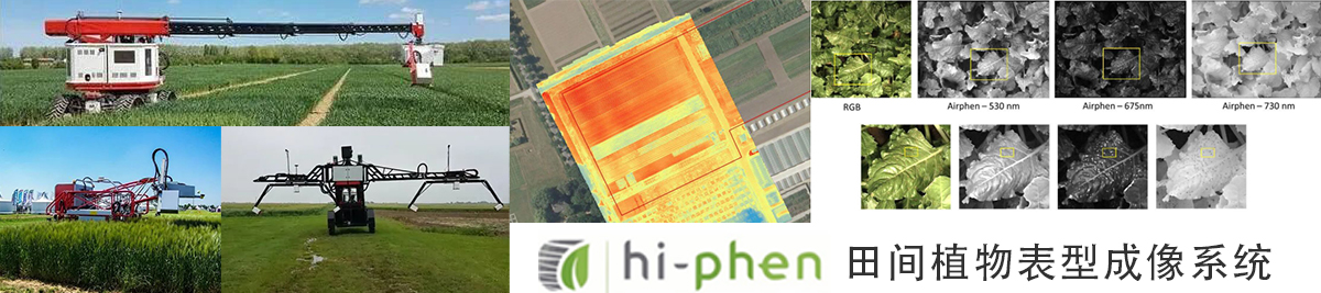
科学家在Plant Phenomics发表利用Airphen多光谱相机进行性状预估的文章
发表时间: 点击:680
来源:北京博普特科技有限公司
分享:

无人机(UAV)的多光谱观测目前已经广泛用于精确农业和作物表型分析应用,用以监测一系列特征,从而表征植被状态。然而,无人机的有限自主性使得在大面积采样时很难完成飞行。因此,在不降低地面采样距离(GSD)的情况下提高数据采集的通量是一个需要解决的关键问题。科学家在该文章提出了一种新的图像采集配置,基于两个焦距光学元件的组合:一个标准视角中带增加了一个mm 毫米光学镜头(SS:单视角)的多光谱相机(DS:双视角,标准两倍)。2018年,使用AIRPHEN多光谱相机在一片玉米地上空连续完成了两次52m高度飞行 。DS飞行计划的设计目的是与4.2mm光学系统镜头实现80%的重叠 ,SS的设计与8毫米光学系统有80%的重叠 。因此,与SS相比,DS覆盖相同区域所需的时间减少了一半。DS配置的地理参考精度得到了提高,尤其是在尺寸方面,因为小焦距光学元件具有更大的视角。对株高估计的应用表明,DS配置提供了与SS配置类似的结果。然而,对于DS和SS配置,降低用于生成3D点云的质量水平会显著降低植株高度估计值。

A Double Swath Configuration for Improving Throughput and Accuracy of Trait Estimate from UAV Images
Wenjuan Li,1,2 Alexis Comar,1 Marie Weiss,2 Sylvain Jay,2 Gallian Colombeau,1 Raul Lopez-Lozano,2 Simon Madec,2,3 and Frédéric Baret2
Show more
Abstract
Multispectral observations from unmanned aerial vehicles (UAVs) are currently used for precision agriculture and crop phenotyping applications to monitor a series of traits allowing the characterization of the vegetation status. However, the limited autonomy of UAVs makes the completion of flights difficult when sampling large areas. Increasing the throughput of data acquisition while not degrading the ground sample distance (GSD) is, therefore, a critical issue to be solved. We propose here a new image acquisition configuration based on the combination of two focal length () optics: an optics with mm is added to the standard mm (SS: single swath) of the multispectral camera (DS: double swath, double of the standard one). Two flights were completed consecutively in 2018 over a maize field using the AIRPHEN multispectral camera at 52 m altitude. The DS flight plan was designed to get 80% overlap with the 4.2 mm optics, while the SS one was designed to get 80% overlap with the 8 mm optics. As a result, the time required to cover the same area is halved for the DS as compared to the SS. The georeferencing accuracy was improved for the DS configuration, particularly for the dimension due to the larger view angles available with the small focal length optics. Application to plant height estimates demonstrates that the DS configuration provides similar results as the SS one. However, for both the DS and SS configurations, degrading the quality level used to generate the 3D point cloud significantly decreases the plant height estimates.
研究中用到的Hiphen公司Airphen相机
Multispectral Camera
The AIRPHEN multispectral camera (https://www.hiphen-plant.com/solutions/airphen/) was fixed on a hexacopter equipped with a two-axis gimbal designed to align the camera vertically downward. The multispectral camera is made of six elementary CMOS cameras with a full width at half maximum close to 10 nm and pixels of 3.04 μm size. Five cameras (blue: 450 nm, green: 530 nm, red: 675 nm, red-edge: 730 nm, and near-infrared: 850 nm) were equipped with an 8 mm focal length lens, with a relatively narrow field of view (FOV) of . The sixth camera (far green: 570 nm) had a 4.2 mm focal length lens with a larger FOV of . The cameras were oriented such as the larger dimension of the image was across-track, defining the swath of the system. The system is called double swath because of the coexistence of two different swaths as well as because the 4.2 mm focal length camera doubles the swath of the 8 mm ones. The six cameras were synchronized and automatically triggered at a 1.0 Hz frequency. The integration time of each of the six cameras was adjusted automatically to minimize saturation and maximize the dynamics. The images were recorded in a 16-bit tiff format along with acquisition time, camera global positioning system (GPS) coordinates, and integration time.


")


